Friday, June 7, 2013

Day 18: A "cross" country experience.

We spent the morning venturing around Luderitz.  We had to stop at the grocery store to resupply, but we also found some of the beautiful old German buildings.  We checked out an old church as well as the home of one of Namibia’s richest diamond giants.  One of the sites we went to was Felsenkirche or the Rock Church, which sits on Diamond Hill.  It was built in 1912 and is one of the oldest Lutheran churches in Namibia.  The location of the church was incredible.  It was right on the water and up on a hill overlooking the rest of the town.  It was locked so we couldn't see the inside, but I'm sure it was lovely.  Another building was called Goerke Haus.  It was built between 1909-1911 for Hans Goerke who was a manager and co-owner for the major diamond company at the time.  The architecture was so interesting and different than anything I had seen in South Africa, or even in other parts of Namibia.  Because of the colonial influences in Africa, it was neat to see all the different styles, from German in Namibia and Dutch/English in South Africa.

In 1487, when Bartolomeu Dias was returning from his voyage around the cape of Africa, his ships stopped along the coast of Namibia, in the bay that Luderitz is now situated.  While there, he erected a stone cross, also called a padrao, on the mainland.  In the 1980s, a replica cross was carved from dolerite and set in the original location.

The drive to the cross was incredible.  The landscape was so interesting and different than anything else we had seen.  During the drive we could see desert dunes, mountains and giant black rocks.  Throughout all of Namibia, not just today, I was struck by the harshness of our surroundings and I often wondered how people, especially those living in isolation, could sustain themselves.  We walked to the end of the point where the cross stood, enjoyed the sea breeze and even saw some seals and porpoises.  After that, we got back in the car and headed east.  We passed the wild horses again and stopped and watched them for a while before we turned off the main road to head south towards South African border.  

Along the main road that brings you to Luderitz is Kolmanskop, a ghost town in the Namib desert.  During the diamond rush in the early 1900s, it used to be rich mining village, as diamond supply decreased, the town was eventually abandoned in the middle of the 20th century.  You actually need a permit to go into the town because it is in diamond mining territory, so we only saw the buildings from the road.


With only a few more days of our trip, we needed to start heading south with a little more purpose.  We made our way back towards the Fish River Canyon National Park, which put us near the border with South Africa.  We drove into the park, stopped the car to watch the sun set and listen to a really lovely but depressing song on Neil’s iPod, and then drove out to find a place to park for the night.  We couldn’t find anything, so we ended up going back in and found an OK place a little ways off the road.  The weather was lovely, so we hung out and watched the moon and stars come out.

Our typical campsite...though the view was not always this good.


Goerke Haus


Felsenkirche (Rock Church)


On the way to the Dias Cross...Neil and his baby.


Leading up to the cross.  It's kind of hard to see, but at the end of the rock point, you can see the outline of the cross.


The lighthouse near the cross...


The ocean view.


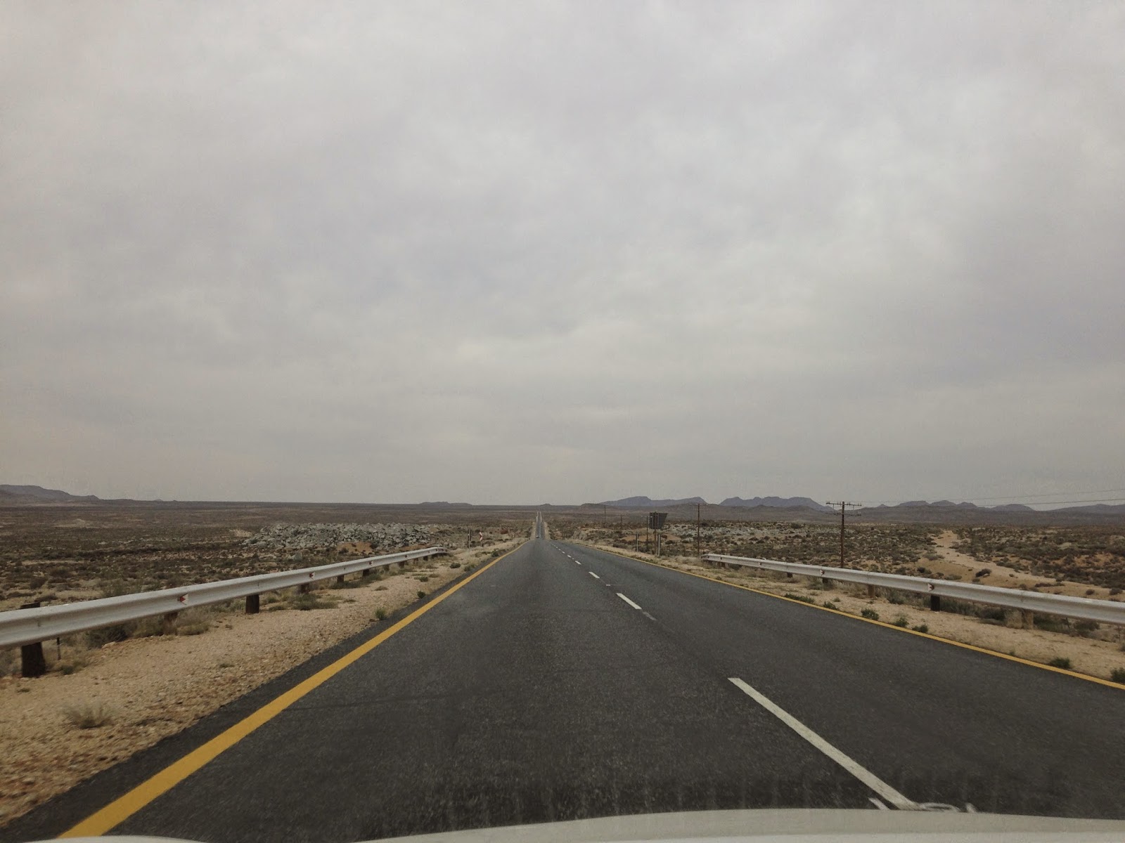
The road heading east.


Kolmanskop in the distance.


The wild horses and their new friends.


** Around 85% of these pictures are Neils.

Day 19: Full Circle

We woke up early in the morning with the rising sun streaming in our tent and the sound of a car slowing down on the road right near where we were staying.  They kept driving, but we immediately got up, packed up in about 3 minutes and got on the road.  We drove a little ways and then stopped to watch the rest of the sun rise, use the facilities and make breakfast.  The last thing that we had decided to do before we crossed the border was go into the Ai-Ais Resort where we would be able to access the bottom of the First River Canyon.  There were also some hot springs that we thought we would check out.

When we arrived, we found the hot springs, which were not as exciting as we had thought they were going to be.  What we really wanted to do, however, was to walk in the bottom of the canyon that we had started our trip our with.  It was cool to be walking in something that was connected to what we had seen before - it was like we ended full circle, back where we had started, but in a new perspective.  After soaking up as much sun as possible, we got back in the car and started the long drive to the town were we were planning to stay for the night.  We crossed the border without any trouble, got another stamp in our passports and were struck with the almost immediate difference in environment.  As soon as we crossed into SA, there was much more vegetation and greenery.


Before we even left, we planned to meet some of our friends from Stellenbosch who were just starting their road trip at a campground near Springbok, SA.  We got there earlier than they did, so Neil and I set up camp, played frisbee with the owner’s little boy and enjoyed hot showers - something that hadn’t been done in a few days.  They were a group of 5 and their car was extremely full.  It was nice to see them, but it was even nicer (Neil and I both agreed) to have someone new to talk too.  It was exciting to hear their plans about where they were going and to give them some tips about where to stay and what they should see.


One of the perks of getting up so early, even though we were a little scared we were going to get in trouble...


Absolutely nothing to see here.  This was what we saw looking out of our windows for awhile.  We stopped just to enjoy the fact that there was literally nothing to see.


If you actually looked at the ground, you could find these tiny little plants.  The leaves were super thick (probably to help retain water in the dry climate) and were very small.  It was interesting to see, how from our perspective, there was nothing, but when you looked a little bit closer, there was life!!!e


The road towards Ai-Ais.  It was still dirt, but the scenery was a little more exciting that earlier in the day.


This was one of the hot springs.  You couldn't feel the water (for safety reasons), but when standing next to the fence, you could feel the heat.


The bed of the canyon.


This was a town right near the border to South Africa.  It was interesting to see that the houses looked like they were made out of a more natural material, while the towns that looked like this in South Africa seemed to be made out of metal.


Back in South Africa - on a lovely paved road.


Thursday, June 6, 2013

Day 17: "Diamonds are Forever"

Although both of us woke up with cramped legs and cricks in our necks, it was nice to finally wake up warm, almost too warm.  Before we left, I was under the impression that it was going to be much warmer than it actually was, especially at night.  Some nights it was really cold even with all my layers.

After making breakfast and converting our car back into a mode of transportation instead of bed, we went into Keetmanshoop.  We walked around town for a little while and tried to get into a cool old church, but it was locked up.  We got back into the car and started heading west, towards Luderitz.  On the way, we passed the wild horses of the Namib, which essentially was a herd of horses that roamed free on the side of the road.  It was kind of strange to see horses in the middle of the "highway."

Luderitz is right on the coast, and is a large port town.  It is well known for its colonial German architecture.  The town was founded in 1883 by German settlers and became one of the sites of concentration camps that were used to exterminate around three thousand native Africans.  The labor from these camps helped build the city and the surrounding railroads.  In 1909, diamonds were discovered and there was a subsequent diamond rush.  Luderitz is on the outskirts of the main diamond mining area in Namibia.  Although this area is closed to the public, we did hop a fence and tried to find some.

When we arrived in the city, the first thing we did was stop at a lighthouse.  We wanted to climb around on the rocks and possibly go into the building to check out the view from the top.  As we climbed the stairs to the door, however, a woman came out and told us that it was actually a private house.  We apologized and left right away.  Since we couldn’t go in the lighthouse, we figured the next best thing was to find a beach.  We drove around the coast a little ways to Agate Beach.  On the way, we stopped at a sign that said on the other side of the fence was diamond mining area and was off limits.  Obviously, we wanted to get on the other side to see if we could find some diamonds.  We hopped over and did a quick search, but found nothing, unfortunately.  We did, however, find the beach and enjoyed the sun and surf.  The weather was perfect and it was so nice to put our toes in the water, but it was a little too chilly for swimming.


We headed back into the town to find a place to stay and ended staying in a beautiful campground right on the water at the end of a point.  We climbed on some of the rocks, watched the sun set and hung out for a while.  After dinner, we listened to the ocean lullaby and were thankful that we could fully extend our legs.

Our "mobile" home.


There was one road that went to Luderitz.  It essentially just shot off west and was straight forever.


Wild horses.  It was strange to just be driving along and then all of the sudden, in the middle of a very  arid environment, see a bunch of horses.

Our first view of the water!!  It was beautiful.  We hadn't seen that much water, beyond the jugs we used for drinking, in a few days.


The lighthouse.


We had stopped at the campground we ended up staying in earlier in the day.  This was the view of the campground.  It was one of the most beautiful places I've ever slept.


We did read the sign...but the temptation was just too great.


A diamond?  Nope, just a rock.


Neil, the pensive diamond hunter.


Our tent site.


Disclaimer:  Neil took all these pictures too.


Tuesday, June 4, 2013

Day 16: The days of old...

Our campsite was located on the "foothills" of the volcano, which is located in southern Namibia.  It's called Brukkaros Mountain and is about 1600 meters at its tallest peak.  About 80 million years ago, the volcano erupted leaving behind a ring of mountains with a large "crater" in the middle.  There are now several paths that one can follow around the perimeter as well as in the interior hollow.  We starting hiking and climbing upwards so we could get a view of the middle as well as the surrounding ring.  It was beautiful hiking and the rocks were really neat and like nothing I had ever seen before.  The view from the top was amazing.  Not only did we have the beautiful view of the mountain ring and inner-depression, but the surrounding landscape and the vast nothingness that surrounded us, made me feel incredibly small and insignificant.  If we had had the time, I think we would have hiked all the way around, but we got to the top of the first little peak, hung out for a little and then made our way back down.

After we packed up the car and headed out of the empty campground, Neil suddenly stopped in the middle of the road, turned the car off and asked me if I was ready to drive.  I never learned to drive stick when I was learning to drive and the cheapest cars were all stick (one of the reasons why Neil was invited because he could drive stick), but I had told him that I would love to learn.  Given the straightness of the road and the fact that we were the only car for miles, it seemed like a pretty good place to learn.  So, we traded seats, he gave me a quick lesson and I was off.  I would be lying if I said I was good at it.  I stalled a few times, made it a little ways down the road, and decided I had had enough.  Neil got back in the driver's seat and we headed off towards Keetmanshoop.

Keetmanshoop is a largish town which was founded by German missionaries in the mid 1800s.  Outside of town there are two quiver tree forests, one of which is a national monument.  The area, according to our guidebook, was also home to some interesting sounding fossils.  The fossil site also had quiver trees, so we figured if we went there it would kind of be like two for the price of one.  We pulled in to the site, met an elderly gentleman named Geil and headed off to the site where he would give us our tour.  The fossils had been discovered by his son in the 80s, while they were working on their farm.  While we walked around and saw the fossils, which had been left where they had first been spotted and covered with small metal roofs, we got a history lesson.  The Permian Period, which started around 280 million years ago, was the dawn of the amphibians, as land reptiles began evolving in favor of more aquatic lifestyles.  One of the first known amphibians was the Mesosaurus, which means "middle lizard" in Greek.  The largest were around 70cm long and had broad tails and webbed feet which helped propel it through the water.  They had a thin snout with small, sharp teeth.  It is unclear however, whether or not these teeth were used to chew or to filter pray.

This period was also categorized by violet dust storms that would leave heavy deposits in the water, essentially drowning the creatures.  The cool thing about the Mesosaurus is that it is used to help justify the idea that the continents were all once connected.  The southern mega continent, which has been named Gondwana, was thought to have a large lake, Lake Gai-As, that was the home of the Mesosaurus.  Around 120 million years ago, the land mass started to split, into the continents of the Africa and South America.  Very similar fossils of the Mesosaurus were found in Namibia as well as in Brazil, which helps show scientists that the two lands may have been connected at one point.

It was super interesting to learn about the fossils and to see them so up close.  We got to hold them in our hands and look and touch the imprints as well as some of the fossilized bone that was left behind.  After our tour, we went to see the quiver trees and the dolerite rocks.  The quiver tree is an aloe species that is endemic to Namibia.  The branches were traditionally used by the San people to make quivers for their arrows, thus its name.  The trees themselves are kind of hard to describe, so you should probably just look at the pictures below.  Around the quiver trees were interesting dolerite rock formations.  These formations were formed around 180 million years ago as the continents began to drift and the surface of the earth went through huge changed.  In this area, magma forced its way through cracks in the surface.  Over the years, because of erosion, the dolerite has been exposed, which is what we were seeing.

Before Geil left us to watch the sunset, he showed us a fun fact about dolerite.  He went over to a specific formation, took two smaller rocks in his hands and then started "playing" the rocks.  I say this because each different spot he struck had a different pitch and when struck in succession, it sounded like music.  He played the South African national anthem for us.  After he left, Neil and I played some rock music, climbed around on the rocks and found a good one to the watch the sunset.

As the sun sank below the horizon, we headed out of the park to find a place to stay.  We found a potential location for parking the car, but as we started to drive off the road, we realized it wasn't going to work.  When Neil turned around, our car started to get stuck.  I got out and pushed, while Neil drove and we made it out.  We found a different place behind a bush, but really close to the road.  We decided that it would probably be better if we didn't have our white car way out in the open, so we camouflaged it by draping my tent over it and we would sleep in the car.  It was a little bit smaller than we were expecting, and much warmer than it usually was in the tent, but without the violent wind we had experienced on the volcano, both of us slept much better than the night before.


This was taken as we approached the interior and started climbing up to get to the top of the ring.


Looking down into the crater in the middle.


Some interesting rocks.


Looking out.  It's a little hard to see, but the horizon is just so flat.  We were the tallest things for miles.

Mesosaurus


Mesosaurus.  If you look close, you can see the different colors inside of the imprint.  Those are remnants of bone.


Up close of foot.


Quiver trees and dolerite.


Disclaimer:  Neil took all these pictures.


Monday, June 3, 2013

Days 14 and 15: Days of Rest...and then Nothing

Because we had nothing major to do the next day, we slept in a little bit and had a leisurely and delicious egg breakfast.  We chatted with a guy, who's name may have been Michael, but who we dubbed Dr. Pangolin, because he had spent around a year studying an animal called the pangolin.  The pangolin is a mammal that kind of looks like an armadillo.  It's covered in scales and curls into a seemingly impenetrable ball when threatened.  Fun fact:  The pangolin is the only mammal with skin that is also covered in keratin scales.  They eat ants and termites, although they do not have any teeth.  Stones that accumulate in their stomachs help break things down.  We had heard about these before we had gone into Etosha, but they're incredibly hard to find.  Dr. Pangolin was one of a handful of pangolin experts and had only a few sightings over his year of research.

We spent the read of the day hanging out and reading before going shopping in what seemed to be a deserted mall.  Neil and I needed to make sure we would have food for ourselves after Thomas left the next day and Thomas needed to make sure he had snacks for his ride back to South Africa.  We decided to find an interesting place to celebrate Thomas' final night with us.  We ended up going to Joe's Beerhouse.  It's kind of hard to explain the kind of character this place had.  Let's just say it was full of knick-knacks of all kinds, had a large fire pit in the center, and served things like Zebra, Kudu and Oryx.  I had either Kudu or Springbok (I can't remember) on top of spatzle with mushrooms.  I was a little hesitant, but it was surprisingly good and it was nice to have something different than rice or cous-cous with beans.


The next day was a little less relaxing than the day before.  We could no longer procrastinate the financial business that needed to be done in order to make suer everyone was paying equal parts.  Thomas and Neil tried to come up with some intense spreadsheet and equation on Thomas' computer, but we finally went old school and did some serious multi-digit addition to figure everything out.  It was no fun, but it needed to happen and we got to sit in the sun by the pool of the CBB.  The three girls who were bringing Thomas back to South Africa in order to take one of his final exams, met us at the hostel in the early afternoon.  We heard a little bit about their adventures and their multiple flat tires, before we said good bye to Thomas.  Neil and I said one last goodbye to the Card Board Box and headed out on our much less direct journey back to South Africa.

We had already decided on some key places we wanted to go and our first stop was an extinct volcano.  We had seen that there was a campground on the outskirts of it, but when we arrived there was no one there.  The buildings were completely empty, the windows gone and the floors were covered with feathers and bird dropping.  Because we had no where else to go and we really wanted to hike into the volcano, we decided to stay at one of the campsites.  It was a beautiful location, but it was a little bit spooky to be staying in such a deserted place.  We climbed to the top of a small hill to watch the sun set and could see only one town on the horizon of our 360ยบ view.  We literally were in the middle of nowhere.  After that, we made dinner and buckled down for an cold and EXTREMELY windy night.

Our home!

We could not leave without sneaking a picture of the van that the Brits were driving.  I think this picture pretty much speaks for itself.

While we were driving, we randomly came across this sign.  We drove past, looked at each other and asked if we had really just passed a sign that said "Tropic of Capricorn."  Obviously, we turned around.  This is a picture of Neil, pretty must being Neil.

Me.  We clearly had been in a car for a while.


The view from our tent.


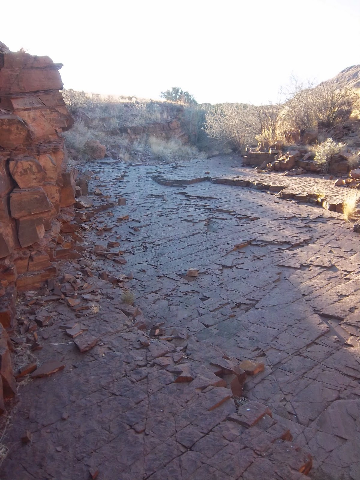
Before heading up the hill to watch the sun set, we walked for a while in a ravine-type thing.  This was what we were walking on.  Neither one of us knew what kind of rock it was, or what would have made all of the lines, but it was pretty neat.


Sunset.

This picture barely does justice to how deserted of an area we were in.  When we were trying to find the road to the volcano, we drove through a tiny village.  There was a school and a tiny store and some, what I would call, homesteads.  It's crazy to think about how isolated these people were, where they got food and what would happen if there was some kind of emergency.  You can see, perpendicular to the horizon, the road that Neil and I drove in on.


Neil took these!


Saturday, June 1, 2013

Day 13: Home. Sweet. Home.

We made it through the night with no lion attacks or questions from our neighbors, who were having a grand old time until the wee hours.  After breakfast, we packed up and drove into the Waterberg Platear National Park.  This park is dominated by flat-topped mountains and has beautiful views and some rare species of wildlife, like the white rhino and sable antelope.  They also are home to Namibia's only breeding colony of Cape vultures.  However, we did not see any interesting wildlife other than a troop of baboons.

We decided that this would be a great place to do some hiking and because Neil and Thomas are, well...Neil and Thomas, we ended up spending a while climbing around on some of the large boulders towards the beginning of the trail.  After they tried several times to get to the top of one boulder, I told them to stand aside and give me a turn.  I must disclose that there is a little debate over whether or not the route that I took included some cheating, but all that matters is that I got to the top before they did and had a great view of their continued struggles!  We continued climbing to the top of the mountain and had a wonderful view of the valley below and Namibia that stretched on all sides.  We hung out for a while at the top, watched a large group of tourists summit as well, and tried to figure out if we were actually hearing someone call for help or if it was only monkeys.

We hiked back down, drove to the entrance, did our dishes in the bathroom and played some frisbee in the parking lot before getting back in the car and making our way home to the Card Board Box in Windhoek.  It was actually like coming home.  The woman who checked us in recognized us and made us feel very welcome and we ended up seeing the crazy Brits who were driving from England to Cape Town that we saw the first time we were at the CBB and who's car we spotted as we were leaving Etosha as well as the two girls from Botswana that we saw the first time and when we were in Swakhopmund.


I don't have many pictures (OK, I only have one) from our hike.


Waterberg Plateau National Park